


Bloom 44 Voting District, Cook County, Illinois
About
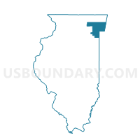
Outline

Summary
| Unique Area Identifier | 567811 |
| Name | Bloom 44 Voting District |
| County | Cook County |
| State | Illinois |
| Area (square miles) | 0.59 |
| Land Area (square miles) | 0.59 |
| Water Area (square miles) | 0.00 |
| % of Land Area | 100.00 |
| % of Water Area | 0.00 |
| Latitude of the Internal Point | 41.54433780 |
| Longtitude of the Internal Point | -87.53533540 |
Maps


Graphs
Select a template below for downloading or customizing gragh for Bloom 44 Voting District, Cook County, Illinois


Neighbors
Neighoring Voting District (by Name) Neighboring Voting District on the Map
- Bloom 40 Voting District, Cook County, IL
- Bloom 5 Voting District, Cook County, IL
- Bloom 72 Voting District, Cook County, IL
- Bloom 82 Voting District, Cook County, IL
- Bloom 88 Voting District, Cook County, IL
- Bloom 95 Voting District, Cook County, IL
- MUNSTER PRECINCT 02, Lake County, IN
Top 10 Neighboring County Subdivision (by Population) Neighboring County Subdivision on the Map
Top 10 Neighboring Place (by Population) Neighboring Place on the Map
Top 10 Neighboring Elementary School District (by Population) Neighboring Elementary School District on the Map
Top 10 Neighboring Secondary School District (by Population) Neighboring Secondary School District on the Map
Top 10 Neighboring Unified School District (by Population) Neighboring Unified School District on the Map
Top 10 Neighboring State Legislative District Lower Chamber (by Population) Neighboring State Legislative District Lower Chamber on the Map
- State House District 80, IL (105,281)
- State House District 29, IL (96,394)
- State House District 1, IN (60,577)
Top 10 Neighboring State Legislative District Upper Chamber (by Population) Neighboring State Legislative District Upper Chamber on the Map
- State Senate District 40, IL (220,404)
- State Senate District 15, IL (194,460)
- State Senate District 1, IN (124,708)
Top 10 Neighboring 111th Congressional District (by Population) Neighboring 111th Congressional District on the Map
Top 10 Neighboring Census Tract (by Population) Neighboring Census Tract on the Map
- Census Tract 8285.06, Cook County, IL (8,544)
- Census Tract 403, Lake County, IN (7,895)
- Census Tract 8285.05, Cook County, IL (6,428)